Mountain Bridge Wilderness Area
Marietta, 29661
Extensive Trails
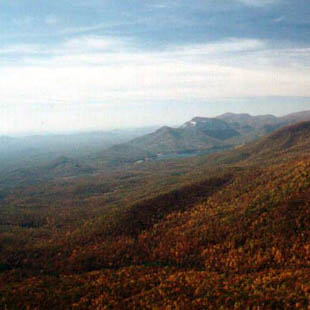
Located in the South Carolina Upcountry, this area encompasses two state parks and more than 10,000 acres. Access to this area can be had from either Cesar's Head State Park or Jones Gap State Park. The name Mountain Bridge refers to the two watersheds that are within the boundries of this area, The Table Rock watershed and the Poinsett watershed. This is the most extensive trail system in South Carolina. Most of the trails are well marked and easy to follow. They trails range from easy creek hikes to strenuous loop hikes that can take all day. What makes this a fun destination is that most anyone of any hiking skill level can enjoy this area.
On any weekend with good weather, many people from all walks of life congregate at the trailhead. Most of the swimming holes for the fist mile of the Foothills Trail are occupied by "regular" people from the Greenville South Carolina area. Next to the North Carolina border, this area has elevations that range from 1400 feet along Oil Camp Creek to 3260 feet at Caesar's Head State Park. Just over the border of North Carolina, a few short miles away, are 5000 foot peaks. Because of the sudden elevation change in just a few short miles, this area is the home to an stunning variety of waterfalls. The elevation change allows for a wonderful variety of plant life, more than 400 species in all. There are some rare varieties as well, some only found in this area.
Unlike much of South Carolina, most of the forest here is a Cove Hardwood Forest ecosystem. More common to the higher elevations in North Carolina, it is present here in the South Carolina Upcountry. Two state records, the Fraser Magnolia and Mokernut Hickory can be found here.
The park also includes restored portions of the old Cleveland Fish Hatchery, offers trailside camping and serves as an access point to the 76-mile Foothills Trail.
