Overview
| Day | Route Focus | Key Roads | Highlight Stops |
| Day 1 | Bridges & a Battlefield | SC-11 East, SC-9, US-176 | Campbell’s Historic Covered Bridge, Strawberry Hill USA, Cowpens National Battlefield |
| Day 2 | The Vertical Ascent & Technical Twisties | US-276 North, US-178, SC-11 | Caesars Head State Park, Table Rock State Park, the Blue Ridge Parkway |
| Day 3 | Western Wilderness & Waterfalls | SC-11 West, SC-130, SC-107, SC-28 | Lake Jocassee Overlook, Oconee Station State Historic Site |
Estimated Mileage Breakdown
- Day 1 (Eastern Loop): 115 miles of sweeping valleys and rolling hills.
- Day 2 (Vertical Ascent): 41 miles OR 145 miles of highly technical, tight mountain switchbacks.
- Day 3 (Western Wilderness): 105 miles of deep forest riding and lakeside curves.

Day 1: Bridges and a Battlefield
- The Ride: Start your tour moving east on SC-11 from your base near Table Rock. This half of the highway serves up smooth tarmac, gentle rolling hills, and panoramic views of the Blue Ridge escarpment to your left.
- The Route: Follow SC-11 East past Gowensville toward Chesnee. Grab breakfast at the cafe at Strawberry Hill, then head on to Cowpens National Battlefield. Loop back using SC-9 North to Hwy 74 West to 108 South to 176 South through Tryon and then Landrum. From Landrum, take SC-14 South to Hwy 11 and back to your lodging.
- Points of Interest:
- Cowpens National Battlefield: Famous for the January 17, 1781, battle where Daniel Morgan led his outnumbered troops against Banastre Tarleton’s British troops, Cowpens offers interpretive facilities, a visitors center with exhibits, a tour road, and a walking trail through the battlefield.
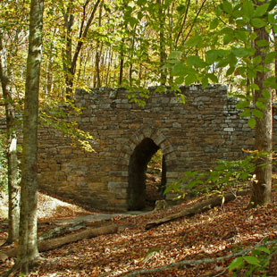
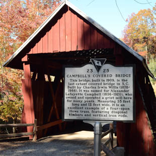
- Poinsett Bridge & Campbell’s Covered Bridge: Take quick detours off SC-11 onto Callahan Mountain Road and Campbell Covered Bridge Road to see SC’s oldest stone and wooden historic bridges.
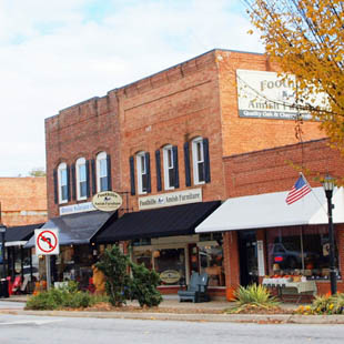
- Strawberry Hill: Stop at this massive farm market in Chesnee for breakfast or a fresh peach or an ice cream break.

Day 2: The Vertical Ascent & Technical Twisties
- The Ride: Today trades sweeping views for knee-dragging technical switchbacks. You will conquer the steepest elevation changes South Carolina has to offer.
- The Route: From your base camp, ride SC-11 to Cleveland and cut north directly onto US-276 North (Geer Highway). Climb the dramatic mountain wall, loop through the high-elevation borders, and descend via the sweeping curves of SC-178 South back to the SC-11 floor.
- Points of Interest:
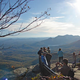
- Caesars Head State Park: The climb up US-276 offers tight hairpin turns and dense tree canopies. Park at the top and walk to the overlook for a sheer 1,200-foot drop view of the Piedmont below.
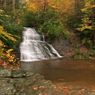
- Wildcat Wayside: A roadside waterfall right off SC-11, perfect for stretching your legs without leaving the bike.
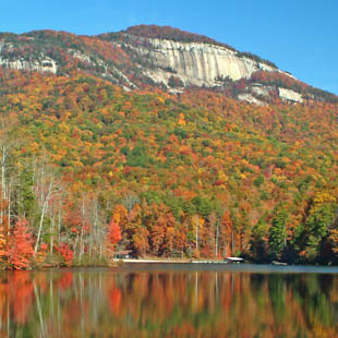
- Table Rock State Park: Stop at the visitor center right on SC-11 to take a classic photo with the towering granite dome of Table Rock in the background.
GET IN MORE MILES
Revised Day 2 Itinerary: The High-Elevation Ridge Loop. This route strings together some of the absolute best motorcycle roads in the Southeast, taking you from the base of the Blue Ridge escarpment up the technical switchbacks of Caesars Head, through the deep gorges of Pisgah National Forest, down to Waynesville, and across the highest elevation stretch of the Blue Ridge Parkway. It finishes with a cruise down the mountain back into South Carolina.
[SC-11 Base Camp] ➔ US-276 North ➔ Caesars Head ➔ Brevard, NC ➔ Waynesville, NC ➔Blue Ridge Parkway North (MP 412 to MP 393) ➔ NC-191 South ➔ NC-225 South ➔US-25 South ➔ [SC-11 Base Camp]
- The Route Extension: Ride up US-276 North past Caesars Head and drop into Brevard, North Carolina. Keep heading north on US-276 as it climbs past Looking Glass Falls. At the very top of the ridge at Waynesville (Milepost 412), merge onto the Blue Ridge Parkway Heading North. Ride the parkway crest for 19 scenic miles to Milepost 393 (Brevard Road/NC-191), then descend back south toward your South Carolina base.
- The Riding Experience: The Parkway features smooth, sweeping bends, a strict 45 mph speed limit, no stoplights, and no commercial vehicles. It contrasts perfectly with the tight, hard-braking hairpins of US-276.
- New Trip Statistics: This upgrade increases Day 2 from 41 miles to 145 miles.
Added Points of Interest Along the Parkway Section:
- Looking Glass Rock Overlook (Milepost 411.5)
- The Stop: A massive paved pull-off offering a head-on view of the giant, sheer granite monolith rising out of the Pisgah forest floor.
- Graveyard Fields (Milepost 418.8)
- The Stop: Located just south of your entry point for a quick 5-minute detour. It features a unique, high-altitude valley landscape with multi-tiered waterfalls visible from the parking area.
- Pisgah Inn & Rest Stop (Milepost 408.6)
- The Stop: Perched at over 5,000 feet of elevation. It is an excellent spot to park your bike, grab a hot coffee or lunch, and sit on the observation deck looking over the entire mountain ridge layout
Premium North Carolina Moto-Attractions
Looking Glass Falls (Brevard, NC) Stop by on the way up to Waynesville.
- The Attraction: A thunderous, 60-foot roadside waterfall that requires zero hiking to see. You can park your bike in the dedicated roadside pull-off and view it directly from the asphalt.
- The Ride: Continue past Caesars Head on US-276 North into NC. The descent down the north side of the mountain features the “Pisgah Forest Twisties”—a highly technical stretch of smooth pavement tracing a rushing mountain river.
Sierra Nevada Resort & Brewery (Mills River, NC) Stop by on the way back from the Blue Ridge Parkway.
- The Attraction: Known as the “Disneyland of Beer,” this massive, multimillion-dollar woodland brewery estate features an outdoor amphitheater, a chef-driven taproom, and dedicated motorcycle-friendly parking sections.
- The Ride: Located just north of Brevard, making it an excellent lunch or early dinner destination to cap off a day of riding the NC state-line loops.

Day 3: The Western Wilderness & Blue Wall Lakes
- The Ride: Head west to tackle the wilder, more remote section of the Cherokee Foothills Byway, featuring deep forest sections and views of deep-blue mountain reservoirs.
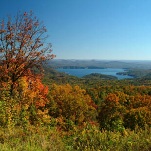
- The Route: Ride SC-11 West. Turn south on SC-133 to SC-183. Turn west to stop at Duke Energy’s World of Energy. From there, head north on SC-130 to briefly enter North Carolina to visit Upper Whitewater Falls, the highest cascading waterfall east of the Rockies. Come back down and turn west onto SC 413 that connects to SC-107 south through the Sumter National Forest. Stop at the Wigington Overlook for spectacular views. Ride down until it merges with SC-28 East into Walhalla. Reconnect with SC-11 to complete the loop.
- Points of Interest:
- Moonshiner 28: The southern terminus of this famous motorcycle route passes right through Walhalla, offering top-tier mountain asphalt and excellent rhythm curves.
- Oconee Station Historic Site: A 1792 stone blockhouse outpost that served as a military frontier post.
- Walhalla: An excellent spot to park the bike along Main Street for lunch at a local pub before wrapping up your tour.
The total estimated distance for this 3-day tour is 261 miles OR 365 miles with the route extension.
Because your base camp is centrally located on Highway 11, the mileage is distributed into manageable daily loops that allow for a relaxed pace with plenty of time for scenic stops.
Where to Stay: Lodging Options Directly on Highway 11
To maximize your riding time and avoid packing up your gear every morning, your best strategy is to book a single “hub-and-spoke” base camp directly along Highway 11. These rider-recommended South Carolina properties offer safe, level parking for motorcycles and easy access to both the paved twisties and the unpaved adventure trails.
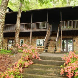
Solitude Pointe Cabins and RV Park
- The Vibe: Premium, secluded wilderness cabins.
- Rider Perks: Fully equipped kitchens, private hot tubs to soak sore muscles, and unpaved, wooded layouts that feel like an extension of the ADV trail.
- The Vibe: Classic, low-key mountain lodge.
- Rider Perks: Front porches lined with rustic log rocking chairs offering direct, towering views of the Table Rock granite dome. It is located right at the geographic center of your 3-day loop.
- The Vibe: Spotless, budget-friendly roadside motel.
- Rider Perks: Park your bike directly outside your door. It is highly convenient for a quick exit onto Highway 11 each morning and is located just five minutes from the state park.
Premium Alternative
- The Vibe: Upscale mountain view resort.
- Rider Perks: Expansive estate grounds with sweeping panoramic valley views. Perfect if you prefer an elegant room, gourmet breakfast, and live weekend music on the patio/wine bar.

Discover more things to do in the area at Scenic11.com

.jpg)